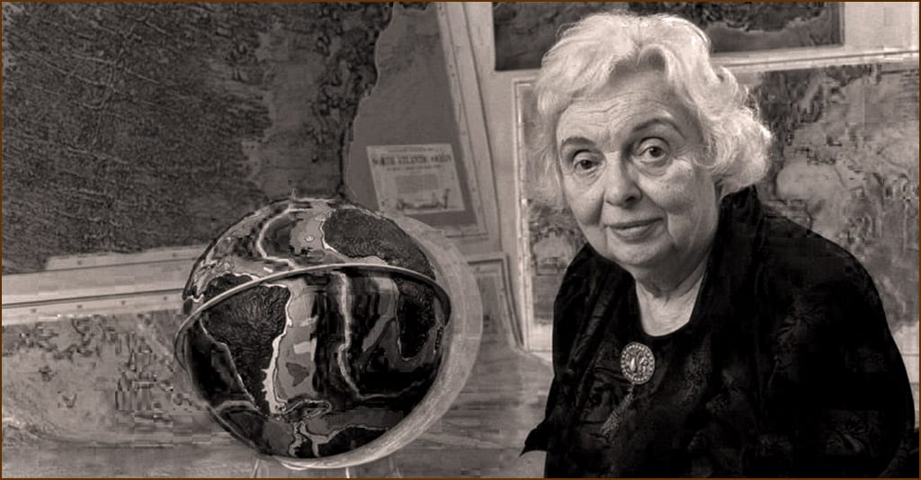
A map of the career of Marie Tharp would look something like a long zig-zag through the male-only barriers of geologic and catographic science until the 1950s when she broke through with a unique new map of the ocean floor and proof that the long-debated theory of “plate tectonics” was true.
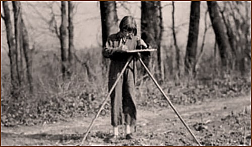
Tharp was born in Michigan in 1920, the only child of a teacher and a soil surveyor for the US Dept. of Agriculture’s Bureau of Chemistry and Soils. She got her first exposure to geology and mapmaking accompanying her father as he collected soil samples and rocks. But young Marie had no interest in pursuing a career in the field; after all, everyone knew that was men’s work. She simply assumed she would go into teaching, like her mother.
Education
Her father’s work kept the family on the move to the extent that Tharp attended more than a dozen different schools. She finally spent a full year in an Alabama public school. It was there she took a class called Current Science, learning about contemporary scientists and their research, and going on weekend field trips to study native trees and rocks — an experience that was a turning point in her life.
After high school, Tharp still planned to become a teacher until her father gave her some advice she never forgot: Choose a subject of study you not only love, but one that will provide you with a career and financial security. At Ohio University, she changed her major every semester, always with her father’s advice in mind, graduating in 1943 with bachelor’s degrees in English and music, along with four minors.
A World War and an Opportunity
A simple advertisement led to her future in cartography. During World War II, when many young men left universities for the military, she saw an ad for women moving into professions like petroleum geology — a traditional no-woman’s land. Curious, and having taken geology classes at Ohio, Tharp applied for and was accepted into the University of Michigan/Ann Arbor’s petroleum geology program, where she completed her master’s degree.

Hired by Standard Oil in Oklahoma as a junior geologist, she soon realized it wasn’t for her. Because women weren’t permitted to go out into the field to look for oil and gas, she was stuck in an office, collecting maps and data from men doing the actual field work. Bored, she took night classes at the University of Tulsa, earning her second bachelor’s degree in science.
Tharp’s mentors, recognizing her talent but knowing what she was up against, encouraged her to stick with it and polish her drafting skills to increase her chances of getting a better job in earth sciences once the war ended. It was sound advice, since women who refused the deskbound duties of analyzing and drawing out results collected by men rarely, if ever, made their mark in the sciences.
The Bruce Heezen Years
After four years in Tulsa, Tharp was ready to take the next step in her career. In 1947 she moved to New York and Columbia University’s Lamont Geological Observatory (now the Lamont-Doherty Earth Observatory), becoming one of its first female employees. There she met Bruce Heezen, a geology grad student, with whom she would collaborate for 30 years.
They began working to define the earth’s submarine topography at a time when knowledge of the ocean floor was limited mainly to harbors and shallow coastal areas used for the safe navigation of ships. But Tharp and Heezen went further, using photographic data to locate downed World War II military aircraft, discovering deep valleys along the ocean floor where US submarines could hide from the enemy, and learning where and how transatlantic cables were being broken.
No Women Allowed
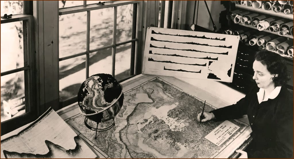
For the first 18 years of their collaboration, Heezen collected bathymetric data from the ocean floors from Lamont’s research ship, the Vema, while Tharp drew maps from that data. Strict Navy regulations prohibited her from going out on the research vessels. But if she had, she would likely have found them less than female-friendly — one of the deep-sea cameras used aboard the vessels chartered by Lamont was known by the boys as “The Pyrex Penis” due to its phallic shape. So Tharp stuck to her drafting table while Heezen gathered data from the sea floor.
She wasn’t allowed to join an oceanographic data-collection expedition until 1968, when she independently used data collected from the Woods Hole Oceanographic Institution‘s research ship Atlantis, along with seismographic earthquake data.
“Girl talk” and science-changing discovery
Before Tharp met Heezen, very little was known about the sea floor. But until scientists learned what the sea floor actually looked like, and how it had evolved, they couldn’t fully understand the earth’s entire structure.
So in 1952, Tharp began painstakingly aligning six years worth of depth-sounding data, creating six profiles running west-to-east across the North Atlantic. From this, she examined the sea floor of the northern sections of the Mid-Atlantic Ridge, identifying a perfectly aligned, V-shaped structure that ran continuously through the ridge axis she believed was a rift valley. Her theory was that this rift valley had been formed over time by the sea floor being pulled apart.
Heezen remained unconvinced. After all, Tharp’s theory supported the then-controversial idea of continental drift — the idea that the continents had moved over geological time, appearing to “drift” across the ocean bed — which many scientists then thought impossible. He dismissed Tharp’s theory as mere “girl talk.”
Jacques Cousteau
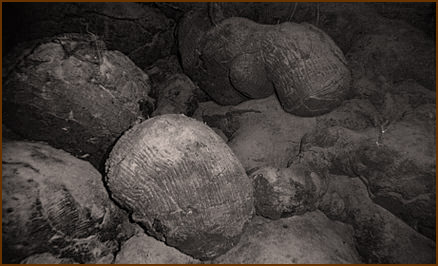
It took French explorer/oceanographer Jacques Cousteau to prove Marie Tharpe right. He didn’t believe the rift valley existed either when he sailed into the Atlantic with an early underwater camera rig, fully intending to prove her wrong. Instead, his photos, shown to a large crowd at the First International Oceanographic Congress in 1959, showed “great black cliffs of the rift valley, sprinkled with white glob ooze, looming up through the blue-green water,” just as Tharp had described in a piece she wrote titled “Mappers of the Deep.” “One image even showed “pillows of lava” newly extruded from the center of the earth.”
Cousteau’s images gave the world its first look at the ocean’s rift valley, helping convince skeptics it really did exist. Finally, only after a man had validated Marie Tharp’s work, scientists had enough evidence to convince them of the now widely-accepted theory of plate tectonics and continental drift.
The World Ocean Floor
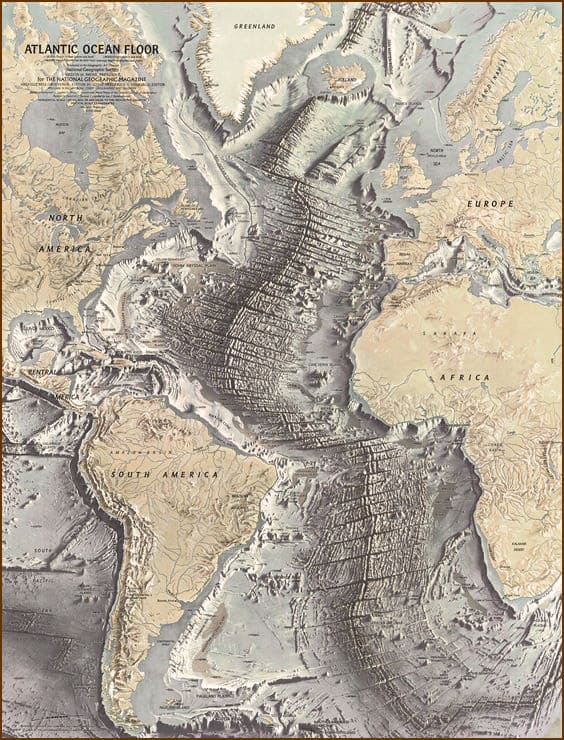
Tharp and Heezen published their first physiographic map of the North Atlantic in 1957. Using SONAR readings from the ocean depths collected by Heezen, Tharp, using only pens and rulers in an incredibly tedious process, drew tiny details of the ocean floor longitudinal degree by latitudinal degree. When she was done, her work illuminated a hidden world of rifts, valleys, volcanic ranges that stretched thousands of miles, and mountain peaks taller than Everest. A second map of the South Atlantic Ocean floor was published in 1961, with the Indian Ocean floor mapped in 1964.
Yet, despite her painstaking work, Marie Tharp’s name did not appear on any of the major papers on plate tectonics Heezen and other male scientists published between 1959 and 1963. Heezen died of a heart attack in 1977 while on a research trip to study the Mid-Atlantic Ridge near Iceland. After his death, Tharp wanted “nothing else but to finish the map (we) started.” That map finally came to life when National Geographic published it under the title “The World Ocean Floor,” and is still used today.
Retirement
After Heezen’s death, Marie Tharp continued to serve on the faculty of Columbia University until 1983, after which she retired, operating a mapmaking and distribution business from her home in South Nyack, New York. She died of cancer at the age of 86 in 2006, leaving no immediate survivors. The place of her burial remains unknown.
Legacy
Marie Tharp was just one of many 20th-century women who worked as geographers and cartographers, particularly in government agencies where individual authorship was seldom acknowledged, and geography and cartography were considered male disciplines. But at a time when fewer than 4% of all earth sciences doctorates between 1920 and 1970 went to women, the fact that she heeded her father’s advice, pursued her passion, and created maps that rocked the world was extraordinary.
As a woman scientist, she rarely received credit for her work. But that changed in 1996, when she received an Outstanding Achievement Award from the Society of Women Geographers; and in 1997 the Library of Congress’ Phillips Society honored her as one of the 20th Century’s Outstanding Cartographers. She received the Woods Hole Oceanography Institution’s Women’s Pioneer in Oceanography Award in 1999 and the first Lamont-Doherty Honors Award from Columbia University, which also created the position of Marie Tharp Research Professor, in 2001.
Her vast collection of materials was donated to the Library of Congress’ Geography and Map Division in 1995. A veritable treasure trove, it includes primary data like ship tracks and bathymetric soundings; bottom profiles; geologic and hydrologic data; information on gravity and magnetism; earthquake and seismic data; and all kinds of data on water and ocean currents.
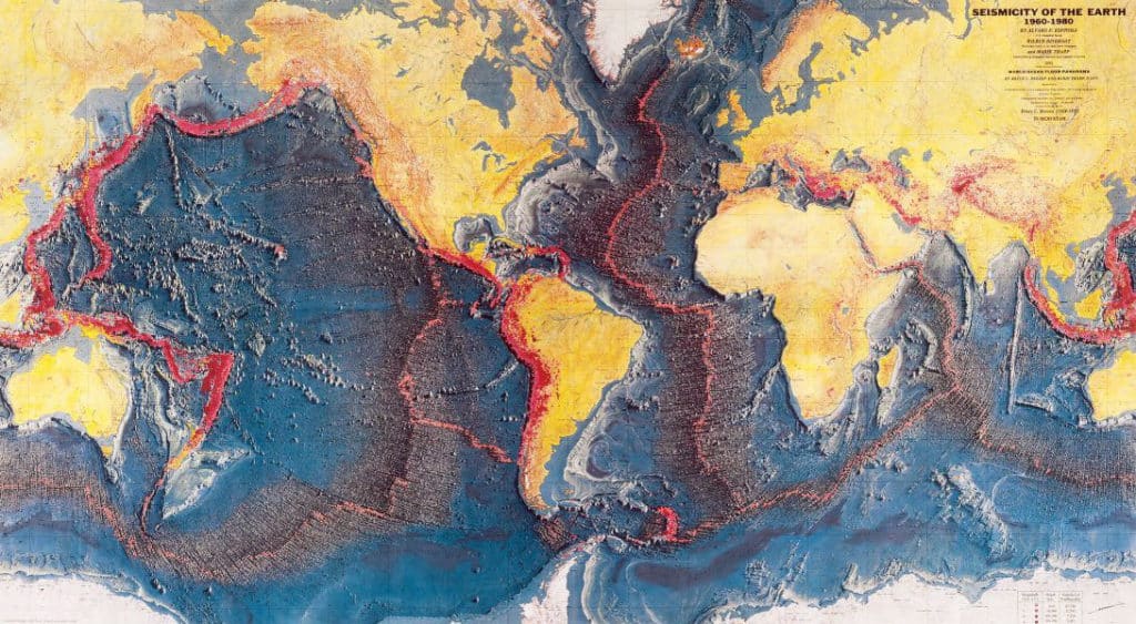
The collection’s secondary data includes Tharp’s specialty — the physiographic diagrams she drew by hand. A manuscript map hand painted by Heinrich Berann, who worked with Tharp for many years, shows the seismicity of the earth, clearly illustrating how earthquakes follow the earth’s shifting plates.
Today her work and her legacy live on. Vicki Ferrini, senior researcher scientist at Lamont, is part of a global collaboration working to map the entire sea floor by 2030, called Seabed 2030. More than 100 years after her birth, Tharp continues to inspire today’s young scientists, who take photos posing as Marie Tharp and snap up Tharp mugs and T-shirts with her picture emblazoned on them.

Hi Sandy,
Thank you for this wonderful article. Like most women I had never heard of Marie Tharp. I hope there will come a time when all people, men and women, will be fairly credited for their valuable work.
Nancy Doyle